
🔴
The Challenge
Public datasets on jobs, housing, income, and crime exist - but they're scattered across Census, BLS, and FBI sources in formats nobody wants to wrangle. Anyone trying to answer a simple question like "where's a good, affordable place to live with strong job prospects?" had to manually cross-reference spreadsheets across thousands of counties. The challenge was turning that raw federal data into something a normal person could explore in seconds.
🔵
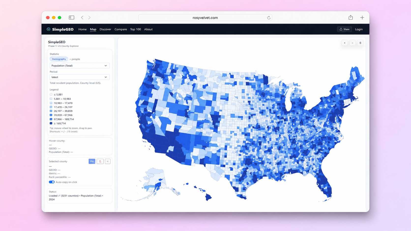
Our Solution
We built SimpleGEO as an interactive county-comparison engine. It ingests and normalizes multiple government datasets, then ranks all US counties against weighted profiles - Balanced, Affordable, Jobs, Family, and Retirement - so a single click surfaces the top picks. Results flow into an interactive map for drill-down, with search by county name, state, or GEOID. The app is built mobile-first with a fast, accessible UI and a graceful no-JavaScript fallback to the map.
🟢
The Results
The result collapses hours of cross-referencing federal spreadsheets into a few clicks: pick a profile, see ranked counties instantly, open the map to explore. It turns disconnected public data into a genuinely usable decision tool.
Project Details
Client SimpleGEO
Industry Non-Profit
Year 2026
Tech Stack
ASP.NET CoreC#BlazorSQL ServerLeafletUS Census ACSBLS LAUSFBI CIUS
📄
Export as PDF
Sales proposal ready
Start a Similar Project
Get in touch